| Map of area around Massawepie - 1858 |
1873 Verplanck Colvin map of the Adirondack Great Land Patents
- Shows Massawepie Lake, Catamount Pond (unnamed), Arab Mt., etc. |
| Map of area around Massawepie - 1896 |
Map of local area near Massawepie - 1896) |
| Map of area around Childwold Park, circa 1900 |
Map of local area near Childwold Park, circa 1900 |
| New York State Museum Geological Map of Saranac Lakes
vicinity including Massawepie, 1900 |
Map of Tupper/Childwold area from Baedeker's
The United States with an Excursion into Mexico, published 1909 |
| Map of New York Central Railroad, Adirondack Division,
showing Childwold and Piercefield, 1912 |
Map of Grasse River Railroad and Connections from 1933 Timetable |
| Map of Grasse River Railroad near Massawepie, early 1900's |
Sketch Map by George W. R. Sykes, showing the location and uses of the various former
hotel buildings during the Sykes Era, 1917-1951 |
| Massawepie Property Map - 1951 |
Route to Massawepie - 1951 |
| Massawepie Reservation Map - 1952 |
Sketch Map of Pioneer on Schedule for
1954 Area IIE OA Conclave at Massawepie |
| Large-scale map of proposed land swap with Staves family - 1957 |
Detailed maps of proposed land swap - 1957:
Near camp entrance
Near Catamount Pond |
| Massawepie Reservation Map - 1958 |
Massawepie Trails Map - 1960s |
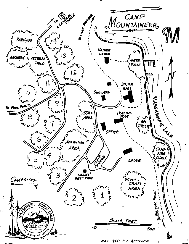
| Camp Mountaineer - 1966 |
Camp Voyageur - 1966 |
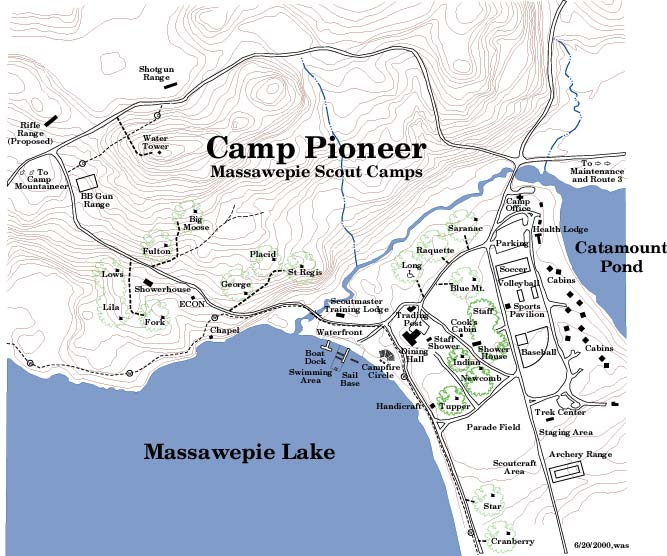
| Camp Pioneer - 1969 |
Camp Forester - 1970 |
| Camp Mountaineer - 1970 |
Camp Voyageur - 1970 |
| Hiking Trails - 1970 |
Hiking Trails - 1972 |
| Hiking Trail Mileages - 1973 |
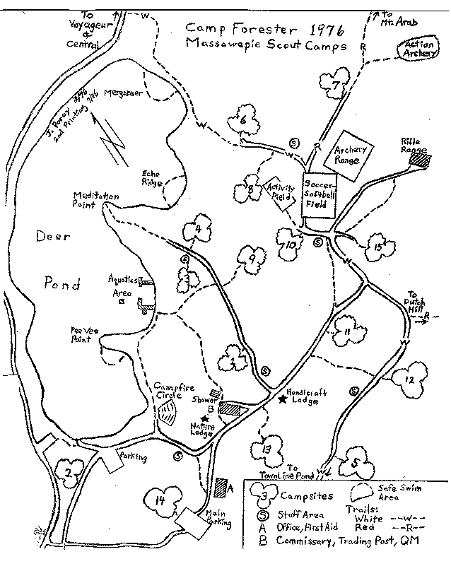
Camp Forester - 1976 |
| Camp Mountaineer - 1979 (drawn by Lonnie Hovey) |
Camp Forester - 1980 (from Bob Lewis' archives) |
| Camp Mountaineer - 1985 |
Camp Forester - 1985 |
| Massawepie Lake Depths - 1990 |
Camp Mountaineer - 1992 |
| Tentative Map of Areas To Be Mentioned in NYS Easement
- Mid-90s |
Central Area - 1990's |
| Preliminary development map for the
"new" Camp Pioneer by BSA National Engineering Service - 1998 |
Illustrated version of Camp Pioneer redevelopment plan as shown in the
fundraising brochure - 1999 |
| Hiking Trails - 1999 |
Topo Map w/Trails - 1999 |
| Camp Mountaineer - 1999 |
Routes to Massawepie - Circa 2000 |
| Camp Pioneer - June, 2000 |
Color Map of Camp Pioneer - July, 2000 |
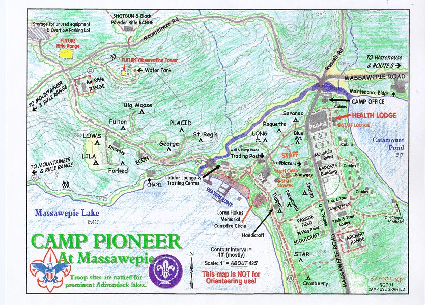
| Color Map of Camp Pioneer - June, 2001 |
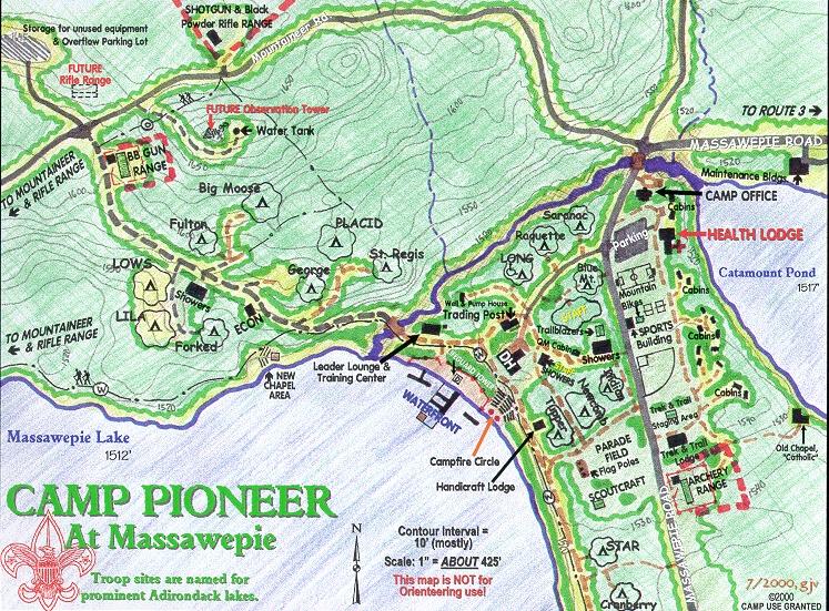
Color Map of Camp Pioneer - 2007 |
| Routes to Massawepie - 2011 |
Color Map of Camp Pioneer - 2016 |
| Color Map of Massawepie Hiking Trails - 2018 |
Massawepie Hiking Trails - 2018 -
optimized for Black & White printing/copying |
| Color Map of Camp Pioneer - 2019 |
Massawepie Hiking Trails - 2021 |
| Color Map of Massawepie Hiking Trails - 2022 |
Massawepie Hiking Trails - 2022 -
optimized for Black & White printing/copying |
| Color Map of Camp Pioneer - 2022 |
Color Map of Camp Pioneer - 2023 |
| New April, 2025:
NYS-DEC Map of Massawepie Easement |
New April, 2025:
Color Map of Massawepie Trails - 2025 |
| New June, 2025:
Color Map of Camp Pioneer - 2025 |
|